Cross-State Geologic Unit Index (CSGUI) Project.
This project aims to create an index of stratigraphic units, noting how they change in description and name from state to state for ease of travel. This project also aims to make surveying in areas near or on state borders easier.
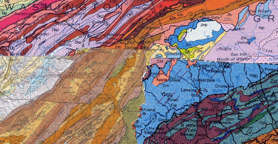
To do this, the first step is Geo-Referencing the maps we are working with onto the globe so they fit together as best they can. This lets us track several units across the borders, and it also makes areas that do not match very obvious, such as when a unit is differentiated in one state and not the other. (The most obvious is the Snowbird Group, which is not differentiated in TN but is in NC)
This project is complete. If you would like the Spreed Sheet, Wright up or map, please email me.
Chemical Analysis of Colorful Speleothems.
This is a new project brought on by a lack of information on the subject of color in speleothems; many of the latest papers only look at a specific cave or a single speleothem. The aim of this study is to test many speleothems of various colors and log the results with the hope that a pattern may be identified. If a pattern is found, this study can hopefully be a foundation for more work done in the future.
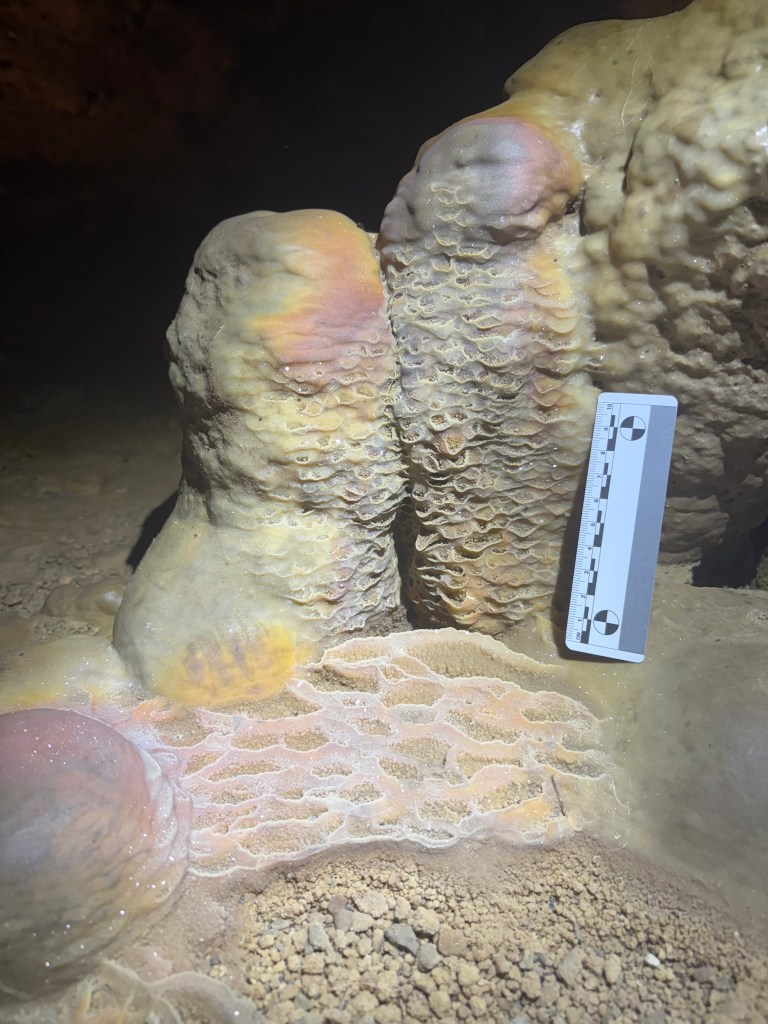
The current method that is being considered for this is to use a pXRF on the speleothems for an elemental analysis.
When this project is completed, the page will be updated.
3D Cave Mapping.
A project that I will be starting likely over the summer of 2026, is to map the entirety of Bristol Caverns with a handheld LiDAR scanner, using photogrammetry to overlay images into the 3d lidar scan, creating a virtual cave that can be used in education.
