This project aims to create an index of stratigraphic units noting how they change in discerption and name from state to state for ease of travel. this project also aims to make surveying in areas near or on state borders easier.
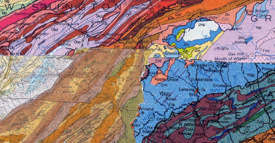
To do this the first step is Geo-Referencing the maps we are working with onto the globe so they fit together as best they can, this lets us track several units across the borders, it also makes areas that do not match very obvious such as when a unite is differentiated in one state and not the other. (the most obvious is the Snowbird Group it is not differentiated in TN but is in NC)
